
From a car or by foot, Houston’s urban sprawl looks a world away from the stark, jagged peaks of Big Bend. But hovering 10,000 feet above transforms the state into a cohesive yet ever-changing topography. Texas’s landscapes become one continuous vista, shaped both by its inhabitants and by nature’s will: the Red River winding through the Panhandle; Interstate 35 weaving across Hill Country; the Piney Woods of East Texas giving way to the bayous of the Gulf Coast.
That’s the vantage point that Jay B. Sauceda captured in his aerial photo series, “Texas From Above,” showing at the Bullock Texas State History Museum starting January 26. Over six days in July 2015, the photographer and pilot documented the 3,822 miles of Texas borders, leaning out of the window of a plane as he flew along the state’s perimeter. “I think a lot about regionalism and what makes Texas unique,” Sauceda says, who is also a co-founder of the Texas Humor brand. “The reason why Texans feel the way they do is a product of our landscape.”
The project, which was commissioned by Texas Monthly, was a natural pairing of the 33-year-old’s decade-long photography career and his lifelong love of planes. As a child in La Porte, he spent weekend afternoons watching military flights take off and land from the nearby Ellington Airport. The young Sauceda was entranced, writing middle school reports on Air Force aircrafts and frequently rewatching Memphis Belle, a drama about a World War II bomber. “Aviation is the perfect intersection of dorkiness and chutzpah,” he says. “There’s the science piece of it, and then there’s getting into a tin can and flying into the air.”
Decades later, as he trained for his pilot’s license in 2014, Sauceda learned about Amelia Rose Earhart, a Colorado-based pilot planning to fly around the world in honor of her namesake. Like any good Texan, he thought about how that could translate to his own nation. “I said to my flight instructor, wouldn’t the most Texan thing in the world be to fly around Texas and call that a flight around the world?” Sauceda remembers. A year later, armed with a medium format camera and several GoPros to affix to the wings, he borrowed his brother-in-law’s Cessna 182 Turbo and began.
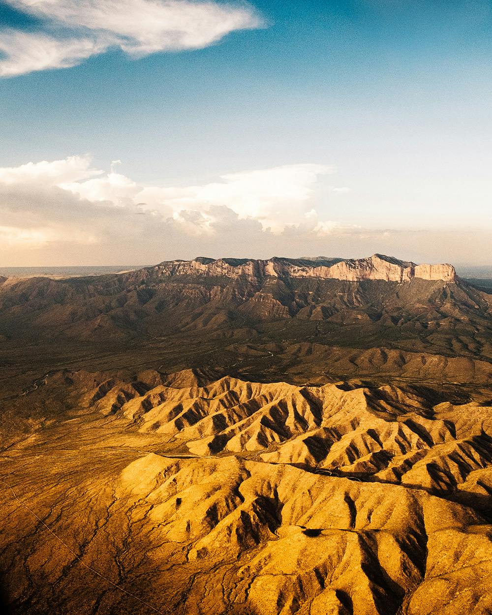
On his trip, Sauceda captured stunning vistas that feel quintessentially Texan: sunset over the Chisos Mountains, grids of refineries in Port Arthur, families packing up their coolers at the end of a summer day on South Padre Island. The distance—he flew at up to 10,000 feet above the ground—allowed him a removed intimacy with his subjects. “I’ve always felt like a camera is a key that allows you to unlock other people’s lives, and flying a plane is the same thing,” Sauceda says. “I’d see one person driving along a road in West Texas and I’d think, what’s on their radio right now? Are they headed home? The inability to really see what people are doing is a cool way to observe life.”
When presented as a series, the grand, sweeping photographs offer a sense of unity and shared perspective. At the Bullock, the photos will be exhibited alongside a mini-documentary on the project, some of the cameras Sauceda used, and computer-like flight simulators allowing visitors to experience part of his trip (available on select days). “Growing up so close to NASA, I heard about how after astronauts go to space and see the entire planet from a zoomed-out view, they come back and have this we-are-the-world mentality,” Sauceda says. “That’s how I feel when I fly: I look down and think, we all have these big personalities and aspirations, but when you compare it to the landscape, we have conquered so little as humans.” Texans have made their mark on the land, but the landscapes themselves have made a far greater impact on what it means to be a Texan.


